About the Long Island Expressway
The Long Island Expressway — officially Interstate 495 and universally known as the LIE — is the spine of Long Island’s highway network and the most heavily traveled road in New York State outside of New York City proper. Officially measured at 66.38 miles (106.8 km) by NYSDOT — commonly rounded to “about 70 miles” — it runs from the Queens Midtown Tunnel portal in Manhattan, across Queens, and east to County Route 58 (CR 58) in Calverton near Riverhead in Suffolk County. The LIE carries an estimated 200,000+ vehicles on a typical weekday. Its legendary congestion has made it a cultural touchstone: New York magazine coined the phrase “world’s largest parking lot” in the 1960s, and the label has endured through every subsequent decade of failed fixes — successive widenings, the addition of median HOV lanes from eastern Queens (Exit 32) through central Suffolk (Exit 64), and three generations of “what to do about the LIE” planning studies.
Explore this corridor
This hub is the canonical entry point for everything we track on I-495. Drill into the parts of the expressway that matter to your trip:
- The LIE in Nassau County — Exits 33–48, interchange-by-interchange, with live crash data and alternate routes.
- The LIE in Suffolk County — Exits 49–73, from Melville to the Riverhead terminus.
- LIE HOV lane rules — hours, occupancy requirements, where the carpool lane runs, and why the Clean Pass exemption ended.
- Live conditions & exit reports — the Live Accident & Traffic Reports section above pulls from 511NY and our own pipeline; high-incident exits link out to their own accident-history pages.
Construction history (1940–1972)
The first piece of what is now I-495 — the Queens Midtown Tunnel, linking Manhattan and Queens — opened on November 15, 1940, under New York power broker Robert Moses. The expressway itself was then built in stages over the next three decades. The first true expressway segment, the Queens–Midtown Expressway between Laurel Hill Boulevard and Maurice Avenue, opened on February 24, 1955; the eastward push through Queens followed the route of the old Horace Harding Boulevard (the section through the borough is still officially the Horace Harding Expressway). The first section outside New York City — a five-mile stretch from the Queens–Nassau line to Willis Avenue in Roslyn Heights — opened on September 30, 1958, and the highway reached Suffolk County in 1962. The eastern terminus at County Route 58 in Calverton/Riverhead was completed on June 28, 1972, finally making the LIE continuous from Manhattan to the East End. (The full route was not formally designated I-495 by AASHTO until May 1984; the Long Island portion east of the Clearview Expressway carried the NY 495 designation from 1958 to the early 1980s.)
Planners reached even further. Robert Moses and the state at various points envisioned extending the expressway onto the North Fork (CR 48 was originally intended to become part of that extension) and even across Long Island Sound to Connecticut or Rhode Island via a chain of bridges and artificial islands. None of those eastern extensions were built — see “The LIE That Was Never Built” below.
How the LIE got its names
The LIE wears several names along its length, a legacy of how it was stitched together. When first reported by Newsday in late 1953, the cross-Island highway was floated as the “Central Motor Expressway.” In Queens, the western portion is officially the Queens–Midtown Expressway (from the tunnel to Queens Boulevard) and then the Horace Harding Expressway (from Queens Boulevard to the Nassau line) — the latter built over the old Horace Harding Boulevard, named for financier J. Horace Harding (1863–1929), who lobbied for a road to reach his country club. (He was no relation to President Warren G. Harding.)
The route’s number changed too. The Long Island portion was signed as NY 24, then redesignated NY 495 in 1958, and only became Interstate 495 end-to-end when AASHTO extended the designation in May 1984. As a spur, I-495 technically “should” have an odd first digit under Interstate numbering rules; its even number is a holdover from when it was a shorter NYC-area connector. The service roads in Queens and western Suffolk even carry their own hidden designations — NY 906A and NY 906B.
From the very start, planners underestimated growth. Long Island’s post-war population exploded from roughly 600,000 in 1940 to more than 2.8 million by 1970, and the LIE’s lanes were overwhelmed almost immediately after each widening. By 1980 the corridor was already over capacity through Nassau and central Suffolk; by 2000 it ranked among the most-congested commuter highways in North America according to the Texas Transportation Institute’s Urban Mobility Report. Today the morning peak typically backs traffic up 20–30 miles westbound from the Suffolk-Nassau line; the evening peak is comparably grim eastbound.
Route geometry
The highway runs roughly east-west, beginning at the Queens Midtown Tunnel’s Manhattan portal in Murray Hill, emerging in Long Island City, Queens, and running the length of Queens — its last Queens interchange is Exit 32 (Little Neck Parkway) — before crossing into Nassau County at Exit 33 (Lakeville Road). In Nassau, it traverses the North Shore communities of Great Neck, Manhasset, and Westbury before passing through the central Nassau spine at Plainview and Hicksville. Crossing the Nassau–Suffolk county line at Exit 48 (Old Country Road, signed Round Swamp Road), the expressway cuts through the developed suburbs of Melville, Commack, and Hauppauge before reaching the more rural, wooded stretches east of Holbrook and Medford — where the Jersey-barrier median gives way to grass, the pavement turns to concrete, and the streetlights end — and ultimately Riverhead. The corridor intersects virtually every other major Long Island artery: the Cross Island Parkway (Exit 31), the Northern State Parkway (which parallels the LIE through Nassau and meets it near Exit 46 in Plainview), the Seaford-Oyster Bay Expressway / Route 135 (Exit 44), Route 110 (Exit 49), the Sagtikos State Parkway (Exit 53), and the William Floyd Parkway (Exit 68), before all eastbound traffic is finally funneled onto County Route 58 (CR 58) at Exit 73 — the eastern terminus in Calverton/Riverhead.
Jurisdiction and patrol
New York State Police Troop L has primary investigative jurisdiction for the LIE across Long Island (Nassau and Suffolk Counties). The Queens section, west of the Nassau County line, is patrolled by NYPD Highway Patrol. The Queens Midtown Tunnel is Port Authority Police territory. Local agencies — Nassau County Police Department (NCPD), Suffolk County Police Department (SCPD), and the various village police forces along the route — provide traffic-control assistance at major incidents but are not the primary investigative agency on this corridor. NYS Police Troop L is also the agency that issues VTL §1180-c citations in posted work zones (where moving-violation fines are doubled).
Speed limits and HOV lane
The posted speed limit on the LIE is 55 mph for the entire Long Island portion. The Queens section is 50 mph. Work-zone and incident conditions can temporarily lower the posted limit, and commercial trucks may face additional restrictions in specific work-zone reductions. New York’s work-zone fines double for moving violations under VTL §1180-c.
The LIE carries one HOV (High-Occupancy Vehicle) lane in each direction, sitting in the median and running from Exit 32 (Little Neck Parkway), near the Queens-Nassau border, east to Exit 64 (Route 112) in central Suffolk County. The HOV lanes are restricted in both directions on weekdays from 6:00–10:00 AM and 3:00–8:00 PM to buses, motorcycles, and passenger vehicles carrying two or more occupants; trailers and commercial trucks are prohibited at all times. Vehicles may only enter and exit the HOV lane at designated openings.
A note on a common misconception: the NY State Clean Pass program, which from 2006 onward allowed solo drivers of certain approved hybrids to use the HOV lanes, ended in 2025. Single-occupant hybrids no longer qualify — the lanes are now strictly 2+ occupants during restricted hours. Enforcement is by NYS Police Troop L, and fines for HOV violations are substantial.
Tolls
The LIE itself is toll-free. The only toll on the corridor is the Queens Midtown Tunnel at the western terminus, operated by MTA Bridges and Tunnels. E-ZPass and Tolls by Mail are accepted; cash collection ended in 2017 when MTA converted to all-electronic tolling. The remainder of the LIE — from the tunnel exit at the Queens-Manhattan border east to Riverhead — has no tolls, no managed-lane congestion pricing, and no scheduled toll proposals as of 2026.
The LIE That Was Never Built
If every plan on paper had been built, the Long Island Expressway would look radically different — and so would the New York region. The corridor accumulated some of the most ambitious (and most quietly abandoned) megaprojects in the area’s history.
- The Mid-Manhattan Expressway (I-495 across Manhattan). The “495” you see on the New Jersey approach to the Lincoln Tunnel is no accident: I-495 was meant to run across Manhattan to connect the Queens Midtown Tunnel with the Lincoln Tunnel. First proposed by Manhattan Borough President Samuel Levy in 1936 and championed by Robert Moses, later versions called for a six-lane elevated highway roughly along 30th Street, ten stories above the street with buildings stacked above and below it — one variation would have punched the roadway through the 6th and 7th floors of the Empire State Building. The I-495 designation was stripped from the project on January 1, 1970, and Governor Rockefeller killed it for good in 1971.
- The Long Island Sound crossing. The state studied extending the LIE east and then north across Long Island Sound to I-95 in Connecticut (Guilford or Old Saybrook) or even Westerly, Rhode Island, via a series of bridges and artificial islands. Funding gaps and fierce public opposition ended every version. A bridge across the Sound from Long Island is a debate that still resurfaces every few years.
- The North Fork & Hamptons spurs. I-495 was intended to push onto the North Fork (CR 48 was reserved for it) and a Hamptons Spur was planned to branch off near Exit 71 (Nugent Drive). Neither was built — which is a large part of why East End summer traffic funnels onto two-lane roads to this day.
- The LIE subway line. A rapid-transit line running in or beside the expressway median — “Chicago ‘L’” style — was proposed as far back as the 1929 and 1939 IND Second System plans and revived in the 1968 Program for Action as a “Northeastern Queens” line to Fresh Meadows and Bayside. Approved in 1968, it was killed in 1973 after voters twice rejected the transit bond issues that would have paid for it. Had it been built, eastern Queens would have a subway today.
- Double-decks and a monorail. To fight the congestion that appeared almost immediately, officials floated stacking four reversible lanes above the Queens roadway and even building a monorail down the corridor. Neither happened; the LIE instead earned its nickname as “the world’s longest parking lot.”
This is the kind of context Wikipedia documents at length but most local drivers never see — and it’s a useful reminder that nearly every congestion fix proposed for the LIE has been tried, shelved, or voted down at least once.
Dangerous Sections
The LIE consistently records the most reported crashes per mile of any non-NYC highway in New York State by total volume. The following exits and segments are documented hot spots based on NYSDOT crash data and Long Island Traffic’s running corpus of accident reports.
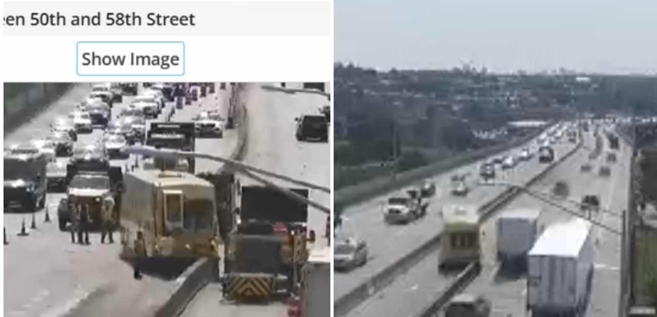
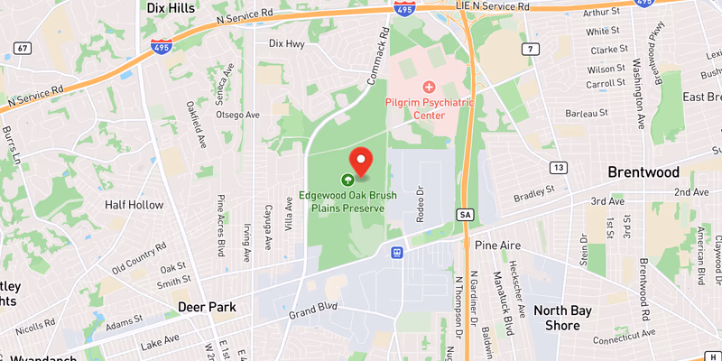
Exit 49 — Route 110 / Walt Whitman Road (Melville/Huntington): The Exit 49 interchange in western Suffolk County is a perpetual accident hot spot. The on-ramp geometry requires drivers merging from Route 110 northbound to cross two travel lanes within a compressed distance. Rear-end and sideswipe crashes are frequent, especially during AM peak when westbound traffic stacks well past this interchange. In May 2026, a 10-foot-wide sinkhole opened in the right lane of the westbound LIE near Exit 49N, partially swallowing a Honda — see Dr. Dao Yuan Han’s geological analysis of why Long Island’s glacial subsurface is uniquely sinkhole-prone.
Exit 53 — Sagtikos State Parkway (Bay Shore): The Exit 53 interchange handles significant traffic between the LIE and the Sagtikos–Robert Moses Parkway corridor leading to Jones Beach. The connector ramps involve high-speed merges, and the nearby overpass columns restrict sight lines. NYSDOT crash data consistently identifies this segment as one of the top-five highest-incident locations on the entire expressway.
Exit 57 — Veterans Memorial Highway / NY 454 (Hauppauge/Islandia): Exit 57 is the primary access point for the Hauppauge Industrial Park — the largest industrial park in the northeastern United States — and carries heavy commercial-truck volume as a result. Truck-related crashes, debris-on-roadway events, and sudden-braking incidents are recurring issues along this stretch.
Exits 33–48 — HOV-Lane Corridor (Nassau County): Through Nassau the LIE carries a median HOV lane in each direction that drivers may only enter or exit at designated openings. Combined with closely spaced interchanges, this produces frequent high-speed weaving as drivers cross several lanes to reach an exit or dive into the carpool lane. Late lane changes in this stretch — particularly during the restricted weekday peak hours — are a recurring crash pattern. See our LIE HOV lane rules for the hours and occupancy requirements.
Exit 19 / Fresh Meadows (Queens): The 188th Street area near Exit 19 is a recurring flooding hot spot. During the May 20, 2026 severe-thunderstorm event, all lanes of the LIE were closed at this location due to flash flooding — covered in our live storm-damage roundup. The drainage system in this segment dates to the 1940s and has been overwhelmed by recent intense-rainfall events.
Towns and Communities Along the Route
The LIE passes through (or borders) the following Long Island towns and hamlets, listed roughly west-to-east:
- Great Neck (Nassau)
- Manhasset (Nassau)
- Plainview (Nassau)
- Melville (Suffolk)
- Commack (Suffolk)
- Hauppauge (Suffolk)
- Holbrook (Suffolk)
- Medford (Suffolk)
- Riverhead (Suffolk)
Each town profile carries its own crash-frequency data, hospital and emergency-services list, and the recent accident archive filtered to that municipality.
Recent Editorial Coverage
Major LIE editorial pieces from the Long Island Traffic data desk:
- Long Island’s Sinkhole Problem Is Real — Three Ground Collapses in Six Days — Dr. Dao Yuan Han’s geological analysis of why the May 14 LIE Melville sinkhole was not a fluke
- LIVE: Storm Damage Roundup — May 20, 2026 — including the LIE Exit 19 / 188th St all-lanes flash-flood closure
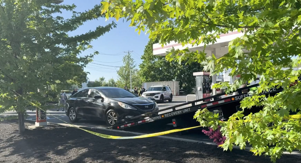
- Wrong-Way Driver on the Long Island Expressway — Dashcam Video
- Six Inches of Rain Paralyzed NYC — Infrastructure Crisis
For the complete LIE accident archive, see /accidents/ and filter by road. The corpus currently runs to several hundred LIE-related reports.
Accident Statistics
The LIE has historically ranked among New York State’s highest-crash corridors by total volume. NYSDOT Motor Vehicle Crash data show approximately 3,000–4,000 reported crashes annually on this corridor, with rear-end collisions comprising roughly 45% of all injury crashes. The Nassau County segments (Exits 33–48) generally see higher crash frequency due to greater traffic density. The Suffolk County segments (Exits 49–73) see higher crash severity due to higher operating speeds and a heavier commercial-truck mix. Rear-end crashes dominate the rush-hour profile; sideswipe crashes cluster in the HOV-lane corridor through Nassau; single-vehicle and rollover crashes are over-represented in the rural eastern segments toward Riverhead.
For the most current picture of conditions on the road right now, the Live Accident & Traffic Reports section above pulls directly from 511NY and our own ingestion pipeline.
If a crash on the LIE left you injured, a Long Island car accident lawyer can explain what your claim may be worth.
References & Further Reading
The history, route, and engineering details on this page are corroborated against authoritative public sources. Live conditions and crash data come from our own ingestion pipeline (511NY, NYSDOT, NYS Police Troop L, NCPD, and SCPD) — see the Sources box at the foot of this page.
- Interstate 495 (New York) — Wikipedia — comprehensive route, history, and exit-list reference.
- NYSDOT Region 10 (Long Island) — the state authority for I-495; route logs and traffic counts.
- NYCRoads / Steve Anderson — Long Island Expressway — the definitive enthusiast history of the LIE and its never-built extensions.
- 511NY (NYSDOT) — official real-time traffic, incident, and work-zone data for the corridor.
- Newsday and The New York Times archives — primary reporting on the highway’s construction (1953–1972) and the canceled Mid-Manhattan Expressway, Long Island Sound crossing, and LIE subway proposals.