State Parkway · Nassau County

Cross Island Parkway Traffic & Accidents

Real-time accident reports, live conditions, and a complete safety guide to the Cross Island Parkway — the western gateway between Long Island and the Bronx via the Throgs Neck and Whitestone bridges.

Running clear No incidents reported this week · as of Jun 30 View live incidents →
Tracked incidents
1
Length
11 mi
Exits
17
Speed limit
50 mph (lower at interchanges and on bridge approaches)
Daily traffic
120k

Route Overview

From
Whitestone Expressway / Throgs Neck Bridge approaches (Whitestone, Queens)
To
Southern State Parkway / Belt Parkway interchange (Valley Stream / North Woodmere line)
Also Known As
Cross Island, Cross Island Pkwy, CIP, cross-island-pkwy, cross-island, NY 907F

Why the Cross Island Parkway Matters

Congestion & Risk

The single busiest parkway interchange complex serving Long Island's west door — the LIE (Exit 30), Northern State/Grand Central (Exit 29), and Belt/Southern State junctions all saturate in both rush directions, and bridge traffic to the Bronx backs onto the parkway daily.

History

Opened 1936-1940 as part of the Moses-era belt system circling Queens. It is the hinge of the entire western Long Island commute: nearly every Nassau-to-Bronx or Nassau-to-Westchester trip touches it, and its 1930s-geometry merges carry 2020s volumes.

The Cross Island Parkway is the western hinge of the Long Island commute — 11 miles along the Queens–Nassau line connecting the Belt Parkway and Southern State at its south end to the Whitestone and Throgs Neck bridges at its north, with the LIE, Grand Central, and Northern State all joining in between. Nearly every Nassau-to-Bronx trip touches it, which is why a single crash at Exit 29 or 30 can ripple delay onto four other highways within minutes.

This page tracks live Cross Island Parkway accidents, closures, and conditions from 511NY, police, and verified news feeds, alongside the permanent safety picture: where the crashes cluster, why the geometry creates them, and what to do when you’re caught in one.

About the Cross Island Parkway

Origins and construction

The Cross Island Parkway opened in stages between 1936 and 1940 as part of the Robert Moses–era belt system that circles the edge of Queens. Like every parkway of that generation, it was engineered for 1930s automobile volumes — short merges, tight cloverleaf interchanges, narrow or absent shoulders, and low stone-faced overpasses. It has carried 21st-century traffic on that 1930s geometry ever since, and the mismatch between original design and modern load is the single fact that explains most of what happens on the road today.

Route geometry: Whitestone and Throgs Neck to the Belt

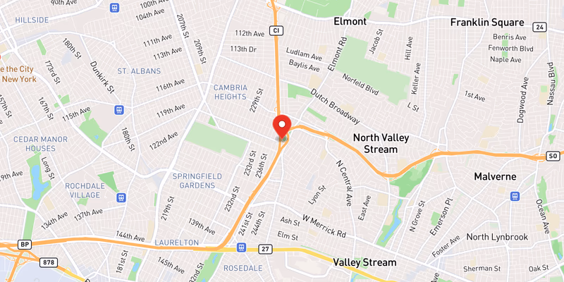
The parkway runs roughly 11 miles down the eastern frontier of Queens, hugging the Nassau line. At its north end it ties directly into the Whitestone Expressway and the approaches to the Bronx-Whitestone and Throgs Neck bridges — the two spans that carry Long Island traffic to the Bronx and Westchester. From there it curves south past Bayside and Bay Terrace, threads the wooded Alley Pond section, and drops toward the Belt Parkway and Southern State Parkway interchange near the Valley Stream / North Woodmere line.

In between, it collects the three busiest connectors on Long Island’s western door: the Long Island Expressway at Exit 30, the Grand Central and Northern State Parkways around Exit 29, and the Belt split at the southern end. Nearly every Nassau-to-Bronx or Nassau-to-Westchester trip touches this one corridor, which is why a single crash here radiates delay onto four other highways within minutes.

The interchange complex at Exits 29–30

The half-mile where the LIE, Grand Central, and Northern State all hand traffic to and from the parkway is the busiest stretch of the whole corridor. Drivers entering from one highway and exiting to another have to weave across the full width of the road in a short distance, often at speed, and the result is the densest concentration of merging and sideswipe conflicts on the Cross Island. When this complex locks up — and in both rush periods it reliably does — the backup propagates onto the connecting highways rather than staying contained on the parkway.

Jurisdiction and patrol

Because most of its length sits inside Queens, NYPD Highway Patrol handles primary enforcement and crash response on the Cross Island. Nassau County Police and the New York State Police pick up incidents that spill across the county line at the southern end, and for crashes on the bridge approaches, MTA Bridges and Tunnels (TBTA) officers are frequently first on scene.

Trucks, low bridges, and over-height strikes

Like all New York parkways, the Cross Island bans commercial vehicles, trucks, and buses — and the ban is enforced physically by Moses-era overpasses too low for box trucks. Over-height vehicles following GPS shortcuts toward the Throgs Neck or Whitestone bridges are a recurring cause of bridge strikes and full closures, one of the most common “Cross Island Parkway closed” events. If you drive anything tall, route it to Sunrise Highway or the LIE instead.

Dangerous Sections

The Exit 29–30 complex generates the heaviest weaving conflicts on the road, for the reasons above. The short-merge entrances along the Alley Pond section feed traffic in with little room to accelerate, producing a steady rear-end cluster. At the south end, the Belt Parkway / Southern State split catches drivers making late, high-speed lane changes as the parkway divides. Corridor-wide, the narrow-to-nonexistent shoulders turn any disabled vehicle into a live hazard with nowhere to go — the same exposure problem we document on the Southern State Parkway. The exits flagged most often in our crash data are 26A, 29, and 30.

Why the Cross Island always backs up

The Cross Island is the hinge between Long Island and every Bronx- or Westchester-bound route, and it is metered from three directions at once. Bridge tolls slow traffic at the north end, the LIE and Grand Central interchanges meter it in the middle, and the Belt merge meters it in the south — so congestion builds inward from all three onto 1930s-era geometry with short merges and minimal shoulders. Weekday rush builds southbound from the Throgs Neck approach in the morning and northbound from the Belt split in the evening, with the Exit 29–30 weave as the choke point in either direction.

Driving the Cross Island safely

Leave following distance you would not normally bother with: the short merges mean cars enter at a speed difference, and the rear-end clusters here are almost all avoidable with space. Pick your lane before the Exit 29–30 complex rather than weaving inside it. If you break down, the shoulders will not protect you — get as far right as you can, exit on the passenger side, and get behind the barrier. And never trust a GPS that routes a tall vehicle onto a parkway; the low bridges do not negotiate.

Cross Island Parkway Conditions Today — Live 6 active

Tuesday, June 30: 3 active accidents, 2 road-work zones, and 0 closures on Cross Island Parkway right now — data from 511NY + police feeds, updated Jun 30, 8:32 PM.

0 high impact 5 moderate 0 low

Recent Cross Island Parkway Incidents

Active Road Work (2 zones)

Moderate impact Both Directions +1 nearby

Exit 27 – Jamaica Avenue

Moderate impact Both Directions

Construction on Belt System - Cross Island Parkway

511 Reported Accidents (3)

Moderate impact Southbound

Crash on Belt System - Cross Island Parkway

1 Left lane blocked

Moderate impact Southbound

Disabled vehicle on Belt System - Cross Island Parkway

1 Right lane blocked

Moderate impact Southbound

SUPERIOR ROAD

1 Right lane blocked

Live data from 511NY, updated Jun 30, 8:32 PM. Impact (Low/Moderate/High) reflects lane closures & closure type, not measured delay.

Latest on Cross Island Parkway 1 total

Accident Statistics

1 Total Reports
0 Critical
0 Fatal

Dangerous Sections

  • 26A
  • 29
  • 30

Towns Along This Route

Frequently Asked Questions

Is there traffic on the Cross Island Parkway right now?

Right now there are 3 active accidents, 3 construction zones, and 0 closures reported on the Cross Island Parkway. This page shows live Cross Island Parkway conditions and refreshes through the day — see the live incidents above for exact locations.

What happened on the Cross Island Parkway today?

No new Cross Island Parkway accidents have been reported in the past 24 hours. This page logs every tracked Cross Island Parkway incident and updates through the day — see recent incidents above for the latest.

What happened on the Cross Island Parkway today?

Check the Live Accident & Traffic Reports section above for the latest Cross Island Parkway incidents. Long Island Traffic ingests 511NY, police, and verified news feeds every 15 minutes; this page rebuilds throughout the day. The corridor's highest-frequency trouble spots are the LIE interchange (Exit 30), the Grand Central/Northern State junction (Exit 29), and the Belt Parkway merge at the southern end.

Where does the Cross Island Parkway run?

The Cross Island Parkway runs roughly 11 miles along the Queens–Nassau border, from the Whitestone Expressway and Throgs Neck Bridge approaches in the north to the Belt Parkway / Southern State Parkway interchange in the south. For Long Island drivers it is the western gateway: connections to the Throgs Neck and Whitestone bridges, the LIE, the Grand Central, the Northern State, and the Belt all happen on this one corridor.

Can trucks use the Cross Island Parkway?

No. Like all New York parkways, the Cross Island bars commercial vehicles, trucks, and buses, with low Moses-era overpasses enforcing the ban physically. Over-height vehicles following GPS shortcuts toward the bridges are a recurring cause of bridge strikes and full closures — one of the most common 'Cross Island Parkway closed' events.

Why is the Cross Island Parkway always backed up?

It is the hinge between Long Island and every Bronx/Westchester-bound route. Bridge tolls meter traffic at the north end, the LIE and Grand Central interchanges meter it in the middle, and the Belt merge meters it in the south — so congestion propagates from three directions onto 1930s-era geometry with short merges and minimal shoulders. Weekday rush builds southbound from the Throgs Neck approach and northbound from the Belt split.

What are the most dangerous sections of the Cross Island Parkway?

The Exit 29-30 complex (Grand Central / Northern State / LIE connections) sees the densest weaving conflicts, and the short-merge entrances along the Alley Pond section are a frequent rear-end cluster. At the southern end, the Belt Parkway / Southern State split catches drivers making late lane changes at speed. Disabled vehicles are a special hazard corridor-wide — shoulders are narrow to nonexistent, the same exposure problem we document on the Southern State.

Who patrols the Cross Island Parkway?

NYPD Highway Patrol covers the parkway through Queens, which is most of its length; Nassau County Police and New York State Police pick up incidents that spill across the county line at the southern end. For crashes near the bridges, Triborough Bridge and Tunnel Authority (MTA Bridges and Tunnels) officers are often first on scene.

Injured in a Cross Island Parkway Accident?

Roads That Connect to the Cross Island Parkway

The Cross Island Parkway interchanges directly with these Long Island highways and parkways — a crash or closure on one routinely backs traffic onto the others. Check live conditions on a connecting corridor before you reroute.

Sources