Roadway · Nassau & Suffolk County

Jericho Turnpike Traffic & Accidents

Real-time accident reports, live traffic conditions, and the most comprehensive safety guide to Jericho Turnpike (NY-25) — Long Island's commercial Main Street running from the Queens border through Nassau into Suffolk. Updated every 4 hours.

Running clear No accidents in 24h · most recent Jun 24, 6:56 AM · as of Jul 1 View live incidents →
Tracked incidents
19
Length
30 mi
Speed limit
30–45 mph (30 mph through village business districts)
Daily traffic
40k

Route Overview

From
Queens border at Floral Park (continues west as Hillside Avenue)
To
Smithtown (NY 25 continues east as Middle Country Road)
Also Known As
Route 25, NY 25, NY-25, Jericho Tpke, the Turnpike

Why the Jericho Turnpike Matters

Congestion & Risk

One of Long Island's busiest surface arterials and among the highest crash-per-mile non-highway roads in both Nassau and Suffolk Counties, driven by hundreds of signalized and driveway conflict points.

History

Follows a colonial-era east–west route across Long Island. Chartered as a private toll turnpike in the early 19th century and named for the Quaker hamlet of Jericho in Nassau County. Later absorbed into the state highway system as NY 25.

About Jericho Turnpike

Jericho Turnpike — signed as New York State Route 25 — is one of Long Island’s oldest and most heavily used surface roads, a commercial spine that has functioned as the island’s east–west “Main Street” since the colonial era. Where the Long Island Expressway moves traffic over Long Island at highway speed, Jericho Turnpike moves it through the heart of every community it touches: an at-grade arterial lined with retail plazas, car dealerships, diners, and downtowns, punctuated by hundreds of traffic signals and driveway cuts. That character makes it indispensable to local life and, simultaneously, one of the highest crash-per-mile non-highway roads in both Nassau and Suffolk Counties.

History

The corridor follows one of Long Island’s original colonial-era post routes. In the early 19th century it was formalized as a privately operated toll turnpike, taking its name from Jericho, the historic Quaker hamlet in central Nassau County that anchored the route. After the turnpike era ended and the road passed into public ownership, it was folded into the state highway system and designated NY 25. The “Jericho Turnpike” name survives on the western portion of that designation, from the Queens border east to roughly Smithtown.

Route geometry (west to east)

The Jericho Turnpike name begins at the Queens–Nassau border in Floral Park, where Queens’ Hillside Avenue becomes NY 25. From there the road runs roughly west-to-east through the dense inner-Nassau suburbs: New Hyde Park, Garden City Park (junction with Nassau Boulevard), and Mineola, where NY 25A splits off to follow the North Shore. Continuing east, it passes through the Williston Park / Albertson area, Roslyn Heights, and into Jericho itself near the Route 106/107 junction and the Route 135 (Seaford–Oyster Bay Expressway) corridor. It then runs through Syosset and Woodbury before crossing into Suffolk County.

In Suffolk, the road threads through Cold Spring Harbor and into the Huntington area, where it crosses NY 110 — one of the busiest signalized junctions on the entire corridor. It continues east through Elwood (along the Dix Hills border), Commack, and into Smithtown, where the Jericho Turnpike name gives way to Middle Country Road. The NY 25 designation itself does not stop there: it carries on east through central Suffolk and out along the North Fork as Main Road, ultimately terminating at Orient Point more than 100 miles from where it started — but only the western ~30-mile segment is what Long Islanders mean when they say “Jericho Turnpike.”

Jurisdiction and patrol

Jericho Turnpike is a state highway maintained by NYSDOT Region 10, but because it is a surface arterial rather than a limited-access highway, day-to-day enforcement falls to local police rather than New York State Police. The Nassau County Police Department (NCPD) patrols the Nassau sections and the Suffolk County Police Department (SCPD) patrols the Suffolk sections, while incorporated-village police departments — including Floral Park and Mineola — enforce traffic within their own boundaries. This patchwork of jurisdictions is one reason crash reporting on the corridor is spread across multiple agencies.

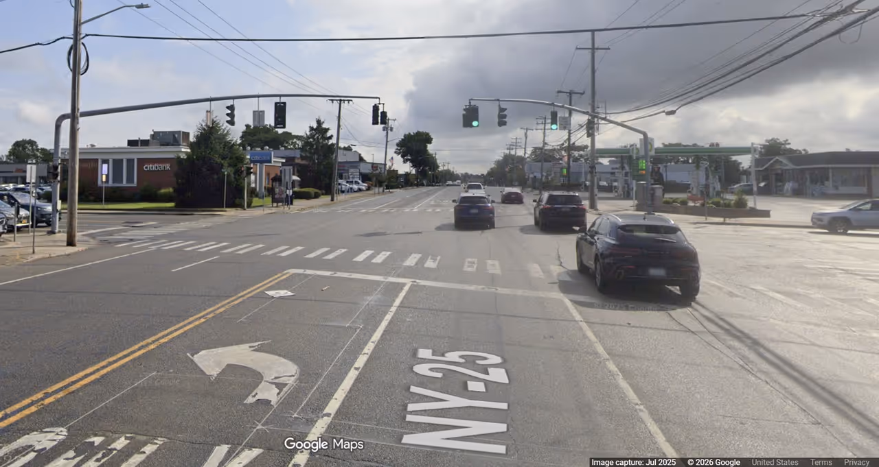
Speed limits and commercial character

Posted speed limits range from 30 mph through village business districts (Floral Park, Mineola, downtown Huntington) to 40–45 mph in less developed stretches. Because the road is an at-grade arterial with frequent signals, crosswalks, and commercial entrances, the posted limit changes repeatedly along the route, and real-world travel speeds during peak periods are far lower. The intense commercial development — strip retail, big-box plazas, auto dealerships, and restaurants — generates a steady stream of turning movements and pedestrian activity that defines both the road’s economic importance and its crash profile.

Dangerous Sections

The following segments are documented hot spots based on NYSDOT crash data and Long Island Traffic’s running corpus of accident reports for NY 25.

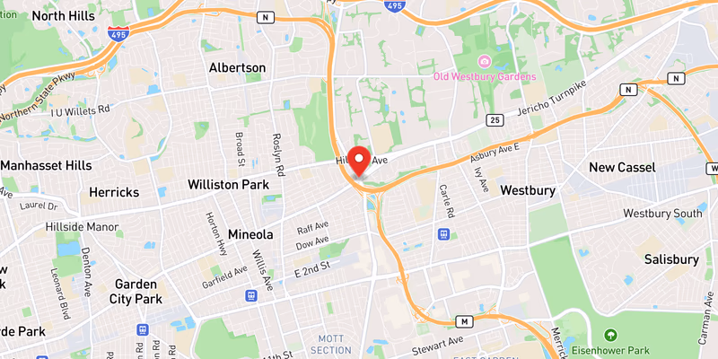
Garden City Park — Jericho Turnpike & Nassau Boulevard (Nassau County): This signalized intersection in the dense western Nassau corridor is a recurring pedestrian-crash location. In February 2026, a 56-year-old man was struck and killed by an SUV while crossing here — see Man, 56, Fatally Struck by SUV on Jericho Turnpike in Garden City Park. Wide crossing distances, heavy turning volumes, and limited pedestrian refuge make crossings on foot especially risky throughout this stretch.

Floral Park & New Hyde Park western corridor (Nassau County): The first few miles east of the Queens border are among the densest on the route, with traffic signals spaced only a few hundred feet apart and continuous commercial frontage. Aging utilities under the roadbed add a secondary hazard: in May 2026, a water main break closed the right westbound lane of NY-25 in this corridor, the kind of sudden lane reduction that triggers rear-end crashes in stop-and-go arterial traffic.

Huntington — Jericho Turnpike & Route 110 (Suffolk County): The crossing of NY 25 and NY 110 in the Huntington/Melville area is one of the highest-volume signalized junctions on Long Island, funneling commercial and commuter traffic between the Route 110 office corridor and the Hauppauge Industrial Park region. Heavy volumes and frequent lane changes produce recurring rear-end and left-turn crashes during peak hours.

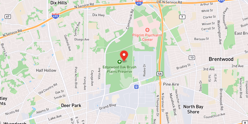
Commack — Jericho Turnpike & East Deer Park Road (Suffolk County): This busy Commack junction has produced serious collisions requiring full closures. In April 2026, a two-vehicle crash here forced emergency crews to perform a roof-and-door extrication and shut Jericho Turnpike in both directions — see Jericho Turnpike in Commack closed as police investigate serious crash.

Elwood / Dix Hills corridor (Suffolk County): The stretch along the Elwood–Dix Hills border sees recurring nighttime impaired-driving crashes. In one April 2026 incident, a Nesconset man was charged with DWI after a crash that shut down Jericho Turnpike in Elwood, reflecting a pattern of late-night, high-speed collisions on the more open eastern segments.

Towns and Communities Along the Route

NY 25 / Jericho Turnpike passes through (or borders) the following Long Island municipalities, listed roughly west-to-east:

Each town profile carries its own crash-frequency data, hospital and emergency-services list, and the recent accident archive filtered to that municipality.

Recent Editorial Coverage

Recent Jericho Turnpike (NY-25) incidents documented by the Long Island Traffic data desk:

For the complete NY 25 accident archive, see /accidents/ and filter by road.

Accident Statistics

Jericho Turnpike’s crash data reflect its character as a high-volume, at-grade arterial with hundreds of conflict points per mile. According to NYSDOT Motor Vehicle Crash data and New York Open Data records, NY 25 ranks among the highest-crash surface roads on Long Island by total volume, with the densely developed Nassau County sections (Floral Park through Jericho) generally showing the highest crash frequency and the more open Suffolk County sections showing higher crash severity tied to higher operating speeds.

Rear-end crashes at traffic signals and left-turn crashes at driveways and unsignalized intersections are the dominant crash types corridor-wide, while pedestrian crashes are over-represented in the dense commercial stretches through Garden City Park, Mineola, and downtown Huntington. Exact annual counts vary year to year and by reporting agency; readers seeking precise figures should consult NYSDOT’s published crash datasets and the NY Open Data motor-vehicle-collision tables rather than relying on a single headline number.

For the most current picture of conditions on the road right now, the Live Accident & Traffic Reports section above pulls directly from 511NY and our own ingestion pipeline.

If a crash on Jericho Turnpike injured you, New York’s filing deadlines are shorter than most expect — it is worth a quick call to a Long Island crash-injury lawyer.

Jericho Turnpike Conditions Today — Live 255 active

Wednesday, July 1: 8 active accidents, 103 road-work zones, and 42 closures on Jericho Turnpike right now — data from 511NY + police feeds, updated Jul 1, 12:02 AM.

44 high impact 67 moderate 42 low 23 EB · 10 WB work zones

Recent Jericho Turnpike Incidents

Active Closures (42)

High impact Both Directions

accidentsAndIncidents on NY 25

All lanes closed
High impact Eastbound

Moriches Road

All lanes closed
High impact Both Directions

on NY 259

High impact Eastbound

Church Lane

All lanes closed · ends 5:00 AM
High impact Both Directions

accidentsAndIncidents on NY 259

All lanes closed
High impact Both Directions

accidentsAndIncidents on NY 25

All lanes closed
High impact Westbound

accidentsAndIncidents on NY 253

All lanes closed
High impact Eastbound

Bridge Branch Road

All lanes closed · ends 5:00 AM
High impact Both Directions

accidentsAndIncidents on NY 256

All lanes closed
High impact Both Directions

accidentsAndIncidents on NY 259

All lanes closed
High impact Eastbound

on NY 25

All lanes closed · ends 5:00 AM
High impact Eastbound

on NY 25

All lanes closed · ends 3:00 AM
High impact Westbound

on NY 25

All lanes closed · ends 5:00 AM
High impact Both Directions

accidentsAndIncidents on NY 259

All lanes closed
High impact Both Directions

accidentsAndIncidents on NY 25

All lanes closed
High impact Westbound

on NY 25

All lanes closed · ends 4:00 AM
High impact Both Directions

on NY 25

All lanes closed · ends 6:00 AM
High impact Westbound

on NY 25

All lanes closed · ends 5:00 AM
High impact Both Directions

on NY 25

High impact Eastbound

on NY 25

High impact

accidentsAndIncidents on NY 258

All lanes closed
High impact Both Directions

on NY 25

All lanes closed · ends 6:00 AM
High impact Both Directions

on NY 25

All lanes closed · ends 6:00 AM
High impact Both Directions

on NY 25

All lanes closed · ends 6:00 AM
High impact Both Directions

accidentsAndIncidents on NY 258

All lanes closed
High impact Eastbound

on NY 25

All lanes closed · ends 6:00 AM
High impact Eastbound

on NY 251

High impact Eastbound

on NY 25

All lanes closed · ends 6:00 AM
High impact Both Directions

on NY 25

All lanes closed · ends 6:00 AM
High impact Both Directions

on NY 25

All lanes closed · ends 6:00 AM
High impact Both Directions

on NY 25

All lanes closed · ends 6:00 AM
High impact Both Directions

on NY 25

All lanes closed · ends 6:00 AM
High impact Both Directions

on NY 25

All lanes closed · ends 6:00 AM
High impact Both Directions

on NY 25

High impact Both Directions

on NY 25

All lanes closed · ends 6:00 AM
High impact Both Directions

on NY 25

All lanes closed
High impact Both Directions

accidentsAndIncidents on NY 25

All lanes closed
High impact Both Directions

accidentsAndIncidents on NY 251

All lanes closed
High impact Eastbound

accidentsAndIncidents on NY 25

All lanes closed
High impact Both Directions

accidentsAndIncidents on NY 258

All lanes closed
High impact Both Directions

accidentsAndIncidents on NY 258

All lanes closed
High impact Eastbound

on NY 252

Active Road Work (103 zones)

High impact Both Directions

Deck work, Bridge work on NY 252

High impact Both Directions

Drainage improvements, Roadwork on NY 25

Moderate impact Westbound +17 nearby

on NY 25

1 Right lane closed · ends 3:00 PM
Moderate impact Both Directions +12 nearby

on NY 25

1 Left lane closed · ends 3:00 PM
Moderate impact Eastbound +12 nearby

on NY 25

1 Right lane closed · ends 3:00 PM
Moderate impact Eastbound +7 nearby

DIX Hills Road

1 Right lane closed · ends 3:00 PM
Moderate impact Both Directions +5 nearby

Traffic signal repairs on NY 254

Moderate impact Both Directions +4 nearby

Overnight roadwork on NY 25

Moderate impact Both Directions +2 nearby

on NY 254

Moderate impact Eastbound +2 nearby

Marcus Avenue

Moderate impact Both Directions +2 nearby

Construction on NY 25

Moderate impact Westbound +1 nearby

Winton Road South

Show 91 more work zones ↓
Moderate Eastbound

I-87 Exit 19

Moderate Both Directions

Drainage improvements, Safety improvements, Utility work on NY 25

Moderate Eastbound

1225 Jefferson Rd

Moderate Eastbound

Terry Road

Moderate Westbound

Roving repairs on NY 25

1 Right lane closed · ends 3:00 AM
Moderate Both Directions

Utility work, Overnight roadwork, Milling, Guard rail repairs on NY 25

Moderate Both Directions

Utility work, Repaving, Drainage improvements, Milling on NY 25

Moderate Both Directions

Barrier repairs, Guard rail repairs, Roadwork, Repaving on NY 25

Moderate Both Directions

Line striping, Repaving, Overnight roadwork on NY 25

Moderate Eastbound

Denton Avenue South

1 Right lane closed · ends 1:00 PM
Moderate Westbound

William Floyd Parkway

1 Right lane closed · ends 2:00 PM
Moderate Eastbound

Traffic signal repairs on NY 254

Moderate Both Directions

Drainage improvements on NY 25

Moderate Both Directions

Line striping on NY 25

Moderate Eastbound

North Coleman Road

Moderate Both Directions

Guard rail repairs on NY 25

Moderate Both Directions

Safety improvements, Drainage improvements, Utility work on NY 25

Moderate Eastbound

Utility work on NY 25

Moderate Eastbound

Bridge Branch Road

2 lanes closed · ends 5:00 AM
Moderate Westbound

Marcus Avenue

1 Right lane closed · ends 3:00 PM
Moderate Both Directions

Drainage improvements, Survey work on NY 25

Moderate Eastbound

Hemlock Lane

Moderate Both Directions

Safety improvements, Utility work, Drainage improvements on NY 25

Moderate Both Directions

Barrier repairs, Utility work, Repaving, Overnight roadwork on NY 25

Moderate Both Directions

Barrier repairs, Utility work, Traffic signal repairs, Repaving on NY 25

Moderate Both Directions

Drainage improvements, Survey work, Roadwork on NY 25

Moderate Both Directions

Traffic signal repairs on NY 250

Moderate Both Directions

Barrier repairs, Utility work, Mowing, Overnight roadwork on NY 25

Moderate Both Directions

Barrier repairs, Repaving, Utility work, Mowing on NY 25

Moderate Northbound

Utility work on NY 250

Moderate Eastbound

William Floyd Parkway

1 Right lane closed · ends 2:00 PM
Moderate Westbound

on NY 252

Moderate Both Directions

Utility work, Milling, Traffic signal repairs, Overnight roadwork on NY 25

Moderate Westbound

Beach Lane

Moderate Both Directions

Installation of traffic management systems on NY 250

Moderate Southbound

William Floyd Parkway

1 Right lane closed · ends 3:00 PM
Moderate Both Directions

Milling, Repaving, Traffic signal repairs on NY 25

Moderate Westbound

I-495 Long Island Expressway

2 Left lanes closed · ends 3:00 AM
Moderate Both Directions

Overnight roadwork, Milling, Utility work on NY 25

Moderate Both Directions

Milling, Utility work on NY 25

Moderate Eastbound

SMITH HAVEN MALL

Moderate Northbound

7550 NY 256

Moderate Eastbound

I-390

Moderate Both Directions

Utility work on NY 25

Moderate Both Directions

Drainage improvements, Roadwork, Survey work on NY 25

Moderate Both Directions

Drainage improvements, Utility work, Guard rail repairs, Repaving on NY 25

Moderate Both Directions

Guard rail repairs, Drainage improvements, Repaving, Utility work on NY 25

Moderate Both Directions

Overnight roadwork, Utility work, Traffic signal repairs on NY 25

Moderate Both Directions

Utility work, Traffic signal repairs on NY 25

Low Both Directions

Utility work on NY 256

Low Both Directions

Utility work on NY 252

Low Both Directions

Utility work on NY 250

Low Eastbound

Utility work on NY 252

Low Both Directions

Utility work on NY 259

Low Both Directions

Crack sealing on NY 252

Low Both Directions

Installation of traffic management systems on NY 257

Low Both Directions

Pothole repair on NY 251

Low Both Directions

Crack sealing on NY 253

Low Both Directions

Utility work on NY 251

Low Both Directions

Tree trimming on NY 257

Low Both Directions

Installation of fiber optics on NY 250

Low Northbound

Booher Hill Rd

Low Eastbound

Herricks Road

All lanes open
Low Both Directions

Crack sealing, Overnight roadwork on NY 251

Low Northbound

Installation of traffic monitoring systems on NY 250

Low Eastbound

on NY 254

Low Both Directions

Traffic signal repairs, Utility work on NY 25

Low Both Directions

Street sweeping on NY 254

Low Both Directions

Crack sealing, Overnight roadwork on NY 252

Low Eastbound

Utility work on NY 251

Low Northbound

Colby St.

Low Eastbound

Overnight roadwork, Repaving on NY 25

Low Eastbound

on NY 25B

right shoulder blocked · ends 3:00 PM
Low Westbound

Laurel Lake Road

right shoulder blocked · ends 3:00 PM
Low Southbound

Utility work on NY 250

Low Both Directions

Roving repairs on NY 25

All lanes blocked · ends 5:00 AM
Low Both Directions

Utility work on NY 253

Low Both Directions

Emergency repairs, Pothole repair on NY 250

Low Northbound

Installation of conduits on NY 250

Low Northbound

Utility work on NY 256

Low Both Directions

Intersection improvements on NY 253

Low Both Directions

Intersection improvements on NY 252

Low Westbound

on NY 25B

right shoulder blocked
Low Both Directions

Guard rail repairs on NY 257

Low Eastbound

Roving repairs on NY 25

right shoulder closed · ends 3:00 AM
Low Both Directions

Construction on NY 250

Low Both Directions

Pothole repair on NY 250

Low Southbound

969 Hilton Parma Corners Rd

Low Northbound

Utility work on NY 259

Low Eastbound

Construction on NY 252

Low Southbound

Construction on NY 259

511 Reported Accidents (8)

Moderate impact Northbound

Nichols Street

1 Left lane blocked

Moderate impact Westbound

Downed tree on NY 25

1 Right lane closed

Moderate impact Northbound

Westside Drive

2 Right lanes blocked

Moderate impact Westbound

Crash on NY 25

1 Right lane closed

Moderate impact Eastbound

Glen Cove Road

1 Center lane closed

Moderate impact Eastbound

Glen Cove Road

1 Right lane closed

Moderate impact Westbound

Watermain break on NY 25

1 Right lane closed

Moderate impact Eastbound

Glen Cove Road

1 Left lane closed

Live data from 511NY, updated Jul 1, 12:02 AM. Impact (Low/Moderate/High) reflects lane closures & closure type, not measured delay.

Latest on Jericho Turnpike 19 total

Accidents by Town

Town-specific breakouts for Jericho Turnpike — every town where we've tracked three or more incidents.

Accident Statistics

19 Total Reports
3 Critical
0 Fatal

Severity mix · 19 reports

3 critical 5 major 7 moderate 4 minor

Dangerous Sections

  • Jericho Tpke & Nassau Blvd (Garden City Park)
  • Jericho Tpke & New Hyde Park Rd (New Hyde Park)
  • Jericho Tpke & Route 110 (Huntington)
  • Jericho Tpke & East Deer Park Rd (Commack)

Towns Along This Route

Frequently Asked Questions

Is there traffic on the Jericho Turnpike right now?

Right now there are 8 active accidents, 205 construction zones, and 42 closures reported on the Jericho Turnpike. This page shows live Jericho Turnpike conditions and refreshes through the day — see the live incidents above for exact locations.

What happened on the Jericho Turnpike today?

No new Jericho Turnpike accidents have been reported in the past 24 hours. This page logs every tracked Jericho Turnpike incident and updates through the day — see recent incidents above for the latest.

What happened on Jericho Turnpike today?

Check the Live Accident & Traffic Reports section above for the latest Jericho Turnpike (NY-25) incidents. Long Island Traffic ingests data from 511NY, the Nassau County Police Department, the Suffolk County Police Department, the National Weather Service, and verified social media every 15 minutes; static-page coverage rebuilds every 4 hours. For the most recent 30-minute window, 511ny.org is the upstream source.

Is Jericho Turnpike the same as Route 25?

Yes. Jericho Turnpike is the common name for New York State Route 25 from the Queens border at Floral Park east through Nassau County and into western Suffolk County. Around Smithtown the same NY 25 designation continues east under the names Middle Country Road and then Main Road, ultimately reaching Orient Point on the North Fork. In Queens, the western continuation of the corridor is Hillside Avenue.

How long is Jericho Turnpike?

The stretch of NY 25 that carries the 'Jericho Turnpike' name runs roughly 30 miles from the Queens border in Floral Park east to Smithtown. The full NY 25 route designation continues well beyond that — east through central Suffolk as Middle Country Road and out to Orient Point as Main Road — for a total of more than 100 miles, but only the western portion is signed as Jericho Turnpike.

What are the most dangerous intersections on Jericho Turnpike?

Documented hot spots include Jericho Turnpike at Nassau Boulevard in Garden City Park (site of a February 2026 fatal pedestrian crash), the dense signalized corridor through Floral Park and New Hyde Park, the junction with Route 110 in Huntington, and Jericho Turnpike at East Deer Park Road in Commack. Left-turn and rear-end crashes at signals, plus pedestrian crashes in the commercial sections, are the dominant crash types corridor-wide.

Why is it called Jericho Turnpike?

The road follows one of Long Island's oldest colonial-era east–west land routes. It was formalized as a turnpike — a privately operated toll road — in the early 19th century and took its name from Jericho, the historic Quaker hamlet in Nassau County that served as a key landmark on the route. After the turnpike era it became a public highway and was eventually designated NY 25.

What is the speed limit on Jericho Turnpike?

The speed limit varies by segment, generally between 30 and 45 mph. Through village business districts and dense commercial stretches — such as Floral Park, Mineola, and downtown Huntington — it drops to 30 mph, while less developed sections post 40–45 mph. Because Jericho Turnpike is an at-grade arterial with frequent signals and pedestrian crossings, posted limits change often along the route.

Who patrols Jericho Turnpike?

Jericho Turnpike is a state route maintained by NYSDOT Region 10, but as a surface arterial it is patrolled by local police rather than the State Police. The Nassau County Police Department covers the Nassau sections and the Suffolk County Police Department covers the Suffolk sections, with incorporated-village police departments (such as Floral Park and Mineola) enforcing traffic within their own boundaries.

What towns does Jericho Turnpike pass through?

From west to east, NY 25 passes through Floral Park, New Hyde Park, Garden City Park, Mineola, the Williston Park/Albertson area, Jericho, Syosset, and Woodbury in Nassau County, then crosses into Suffolk County through Cold Spring Harbor, Huntington, Elwood, Commack, and Smithtown. East of Smithtown the route continues as Middle Country Road and Main Road toward Riverhead and the North Fork.

Why does Jericho Turnpike have so many accidents?

Jericho Turnpike is a high-volume at-grade arterial lined with retail, restaurants, and commercial driveways. Hundreds of signalized intersections, unsignalized driveway cuts, and pedestrian crossings create constant conflict points. Left-turn crashes at driveways, rear-end crashes at signals, and pedestrian strikes in the densest commercial stretches make it one of the highest crash-per-mile non-highway roads on Long Island.

Where does Jericho Turnpike start and end?

The Jericho Turnpike name begins at the Queens–Nassau border in Floral Park, where Queens' Hillside Avenue transitions into NY 25, and continues east to Smithtown. From there the NY 25 designation carries on as Middle Country Road through central Suffolk and as Main Road through the North Fork, ending at Orient Point.

Injured in a Jericho Turnpike Accident?

Roads That Connect to the Jericho Turnpike

The Jericho Turnpike interchanges directly with these Long Island highways and parkways — a crash or closure on one routinely backs traffic onto the others. Check live conditions on a connecting corridor before you reroute.

Sources