About the Bethpage State Parkway
The Bethpage State Parkway — locally “the Bethpage Parkway,” ceremonially the Philip B. Healey Memorial Parkway, and carried on NYSDOT records as the unsigned reference route NY 907E — is one of Long Island’s shortest and most single-purpose parkways. Running just 2.49 miles north–south through eastern Nassau County, it exists for one reason: to carry passenger vehicles from the Southern State Parkway up to Bethpage State Park, the sprawling public golf complex whose Black Course has hosted the U.S. Open, the PGA Championship, and the 2025 Ryder Cup. It is a two-lane park-access road, not a commuter trunk line, and its traffic personality reflects that — quiet most of the time, then sharply saturated on tournament and warm-weather weekends.
Construction history (1934–1936)
The Bethpage State Parkway was built between 1934 and 1936 under the Long Island State Park Commission during the Robert Moses parkway-building era, opening in 1936 alongside the rapidly growing Bethpage State Park. Like Moses’s other landscaped parkways, it was conceived as a recreational road — a scenic, truck-free approach to deliver families to the park’s new golf courses rather than to move freight or heavy commuter volume. The original roadway was a narrow 22-foot-wide undivided pavement offering one lane in each direction.
The corridor’s character changed over the following decades as eastern Nassau filled in with postwar housing, and what began as a leisure road became a short-hop commuter connector. In 1977, maintenance responsibility was transferred from the park commission to the New York State Department of Transportation (NYSDOT), while ownership of the road and the surrounding parkland stayed with the NYS Office of Parks, Recreation and Historic Preservation (OPRHP). NYSDOT subsequently modernized the parkway to contemporary safety standards — wider 12-foot travel lanes, 10-foot shoulders, improved reflective signage, and impact attenuators at fixed hazards.
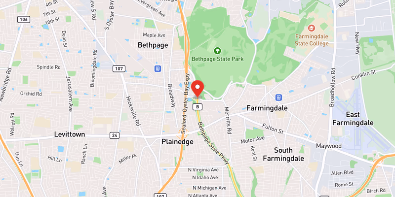
Route geometry (south to north)
From its southern terminus at the Southern State Parkway (Exit 31) in North Massapequa, the parkway heads north through a trumpet interchange (Exit B1) and climbs into the Plainedge / South Farmingdale neighborhoods. It serves Boundary Avenue (Exit B2), then reaches its busiest cross-traffic junction at Hempstead Turnpike / NY 24 (Exit B3) on the Plainedge–South Farmingdale line. Continuing north, it serves Central Avenue (Exit B4) near Bethpage before terminating at a traffic circle inside Bethpage State Park. From that circle, Plainview Road connects north toward the Seaford–Oyster Bay Expressway (NY 135) and the Bethpage State Park golf courses. All crossroads — and the LIRR Main Line — are grade-separated, and a dedicated bike path (the Bethpage Bikeway) runs along the east side of the parkway corridor.
Jurisdiction and patrol
New York State Police Troop L holds primary patrol and crash-investigation authority on the Bethpage State Parkway, the same agency responsible for the LIE, Northern State, and the rest of Long Island’s parkway network. The roadway is maintained by NYSDOT, but ownership and the adjoining parkland remain under OPRHP, and NY State Park Police cover the grounds inside Bethpage State Park itself. The Nassau County Police Department (NCPD) assists at major incidents but is not the primary investigative agency on the parkway mainline.
Speed limits, trucks, and the park circle
The posted limit on the open mainline is 55 mph, with lower posted limits on the interchange ramps and approaching the Bethpage State Park traffic circle at the northern end, where through traffic must slow sharply for the roundabout. As a New York State parkway, the Bethpage prohibits all commercial vehicles, trucks, and buses — it is a passenger-vehicle-only road by design. Over-height rental vans and box trucks that follow GPS onto the parkway remain a recurring nuisance, since neither the grade-separated overpasses nor the park circle were built for commercial traffic.
Dangerous Sections
For so short a road, the Bethpage Parkway’s crashes cluster tightly at its interchanges and its terminal circle. The following segments are the documented conflict points based on NYS Police-reported incidents in Long Island Traffic’s running corpus and the parkway’s known geometry.
Southern State Parkway trumpet interchange (Exit B1, North Massapequa): The confluence with the Southern State Parkway is the single highest-conflict location on the corridor. The compact trumpet geometry forces parkway-speed merging and weaving in a short distance, and southbound traffic must thread into one of Long Island’s busiest east–west parkways. Rear-end and sideswipe crashes are the recurring pattern here.
Hempstead Turnpike interchange (Exit B3, Plainedge / South Farmingdale line): The NY 24 interchange mixes heavy local cross-traffic — Hempstead Turnpike is a major surface arterial — with through parkway movement. Merging conflicts and abrupt speed changes near the ramps drive a steady share of the corridor’s reported crashes.
Bethpage State Park traffic circle (northern terminus): The parkway ends at a traffic circle, requiring a sharp transition from a 55 mph mainline into a low-speed roundabout. Drivers unfamiliar with the circle, or arriving during a park-event surge, misjudge the speed drop and yield rules — a classic roundabout-entry crash profile that intensifies on tournament and peak golf-season days.
Two-lane mainline (corridor-wide): Most of the parkway is one lane in each direction with limited passing opportunity. A single disabled vehicle or sudden braking can stack traffic quickly, and the narrow recreational-era footprint leaves little room to recover despite the later shoulder-widening improvements.
Towns and Communities Along the Route
The Bethpage State Parkway runs through and borders the following Nassau County communities, listed south to north:
- Massapequa (Nassau) — North Massapequa is the parkway’s southern gateway at the Southern State interchange
- Farmingdale (Nassau) — the South Farmingdale area flanks the parkway at the Hempstead Turnpike interchange
- Plainview (Nassau) — Plainview Road links the park circle north toward the Seaford–Oyster Bay Expressway
Each town profile carries its own crash-frequency data, hospital and emergency-services list, and a recent accident archive filtered to that municipality.
Recent Editorial Coverage
Recent Long Island Traffic reporting and incident records touching the Bethpage corridor and Bethpage State Park:
- NYSP: Personal-Injury Accident on the Bethpage State Parkway — a two-vehicle, one-injury crash logged directly on the parkway
- Drunk Box Truck Driver Kills 32-Year-Old Man on Hicksville Road in Bethpage — a fatal DWI crash in the surrounding Bethpage community
- Teen Bicyclist Airlifted After Tesla Collision in Bethpage — a serious vulnerable-road-user crash near the parkway corridor
- Ryder Cup at Bethpage: Road Closures Before and During the Tournament — how a marquee Black Course event reshapes parkway and area access
- Getting to the Ryder Cup at Bethpage Black: Road Closures and Transit Information — the access guide for the park the parkway was built to serve
For the complete Bethpage-area accident archive, see /accidents/ and filter by road.
Accident Statistics
The Bethpage State Parkway is one of the lower-volume corridors in Long Island Traffic’s coverage, and we keep this section honest about that. At roughly 2.5 miles with no commercial-truck traffic and modest daily volume, the parkway generates far fewer total crashes than the LIE, the Southern State, or the Northern State. The reported incidents that do appear — drawn from NYS Police Troop L crash logs and NY Open Data — are concentrated at the Southern State trumpet interchange (Exit B1), the Hempstead Turnpike interchange (Exit B3), and the Bethpage State Park traffic circle at the northern terminus, with the two-lane mainline contributing occasional single-vehicle and rear-end events.
Rather than publish a fabricated annual crash total, we describe the qualitative picture: a short, comparatively low-traffic park-access parkway with localized interchange and roundabout hot spots, where event-day and warm-weather surges tied to Bethpage State Park drive the sharpest spikes in volume and conflict. These characterizations are attributed to NYSDOT crash reporting and NY Open Data; exact counts vary year to year.
For the most current picture of conditions on the road right now, the Live Accident & Traffic Reports section above pulls directly from 511NY and our own ingestion pipeline.